Delaware County Map
Labeled county boundary map and complete directory of all 3 counties in Delaware (DE, State FIPS 10). View 5-digit FIPS codes, county seats, land area in square miles, and official county government websites below.
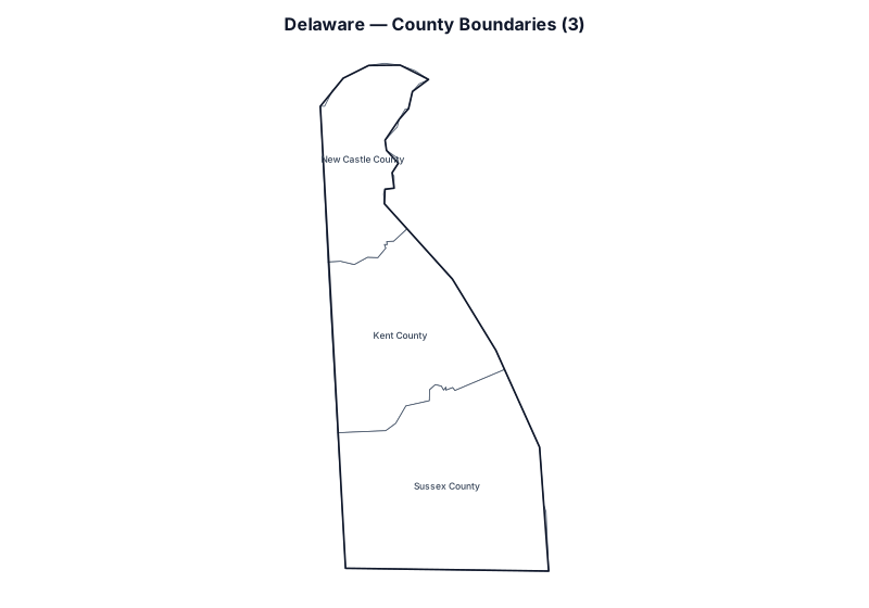
Showing all 3 counties in Delaware. Use the search box below to filter by county name, 5-digit FIPS code, or county seat.
Delaware County Statistics & Summary
Total Counties
3
Largest by Land Area
Sussex County
Smallest by Land Area
New Castle County
All 3 Counties in Delaware (FIPS, County Seat & Official Website)
| County Name | 5-Digit FIPS | Seat / Administrative Center | Land Area (sq mi) | Coordinates | Official Website |
|---|---|---|---|---|---|
| Kent County | 10001 | Dover | 586.1 | 39.097°, -75.503° | Official Site |
| New Castle County | 10003 | Wilmington | 426.3 | 39.576°, -75.644° | Official Site |
| Sussex County | 10005 | Georgetown | 936.2 | 38.673°, -75.337° | Official Site |
How Delaware Counties and 5-Digit FIPS Codes Work
In U.S. Census Bureau TIGER/Line geography, Delaware (DE) is assigned the 2-digit state Federal Information Processing Series (FIPS) code 10 and covers 1,949 square miles of land area across 3 counties in the Eastern Time (ET) zone (with Dover as the state capital). Every county in the directory above carries a unique 5-digit GEOID formed by combining state prefix 10 with a 3-digit county code (ranging alphabetically from Kent County at 10001 to Sussex County at 10005).
Because U.S. Postal Service 5-digit ZIP Codes follow mail carrier delivery routes rather than local government borders, many postal addresses in Delaware carry a neighboring city’s mailing name or sit inside a multi-county ZIP Code Tabulation Area (ZCTA). Property tax assessments, deed recording, circuit and county court venue, voter registration precincts, sheriff jurisdiction, and county sales tax rates in Delaware are determined by the legal county boundary shown on the map above rather than the postal city name on an envelope.
Land area figures in square miles and internal centroid coordinates (INTPTLAT, INTPTLON) come directly from the U.S. Census Bureau’s current TIGERweb State_County benchmark, while 3 administrative seats and 3 verified official government websites are cross-referenced from Wikidata (CC0). Need a clean outline worksheet without county labels, or want to verify which Delaware county a specific home or business address sits in? Open the Blank Map of Delaware, run a street-segment check on Address to County Lookup, check multi-county postal overlap on ZIP Code to County Lookup, or browse all 50 states on the National U.S. County Map.
Adjacent State County Maps
Explore county maps and FIPS directories for states bordering Delaware: