Blank Map of the United States
Download or print a clean, blank outline map of the United States (all 50 states and the District of Columbia) in Albers Equal-Area Conic projection with Alaska and Hawaii insets. Switch between state borders and all 3,144 county lines, or pick an individual state below.
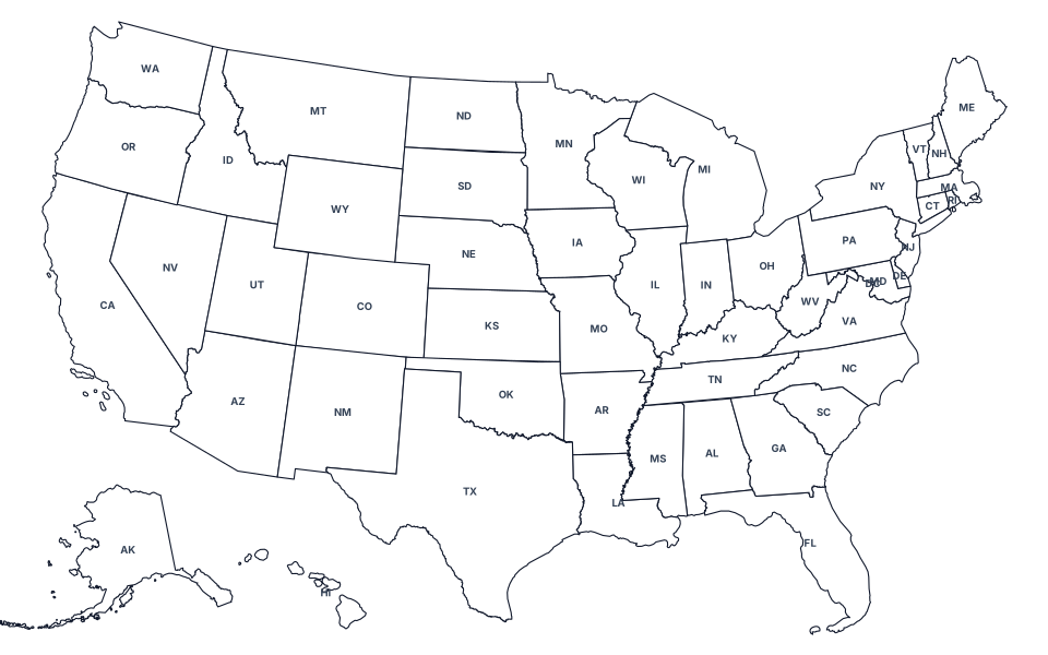
Showing blank outline map of the 50 U.S. states and D.C. Switch to With County Lines above to overlay all 3,144 county boundaries.
Printable Blank Maps for All 50 States and D.C.
Select any state below to open its individual printable blank outline map and county boundary worksheet:
- Alabama (AL)
- Alaska (AK)
- Arizona (AZ)
- Arkansas (AR)
- California (CA)
- Colorado (CO)
- Connecticut (CT)
- Delaware (DE)
- District of Columbia (DC)
- Florida (FL)
- Georgia (GA)
- Hawaii (HI)
- Idaho (ID)
- Illinois (IL)
- Indiana (IN)
- Iowa (IA)
- Kansas (KS)
- Kentucky (KY)
- Louisiana (LA)
- Maine (ME)
- Maryland (MD)
- Massachusetts (MA)
- Michigan (MI)
- Minnesota (MN)
- Mississippi (MS)
- Missouri (MO)
- Montana (MT)
- Nebraska (NE)
- Nevada (NV)
- New Hampshire (NH)
- New Jersey (NJ)
- New Mexico (NM)
- New York (NY)
- North Carolina (NC)
- North Dakota (ND)
- Ohio (OH)
- Oklahoma (OK)
- Oregon (OR)
- Pennsylvania (PA)
- Rhode Island (RI)
- South Carolina (SC)
- South Dakota (SD)
- Tennessee (TN)
- Texas (TX)
- Utah (UT)
- Vermont (VT)
- Virginia (VA)
- Washington (WA)
- West Virginia (WV)
- Wisconsin (WI)
- Wyoming (WY)
How This Printable Blank United States Map Is Built
This printable blank outline map of the United States is generated directly from the U.S. Census Bureau’s cartographic boundary files (cb_2023_us_state_20m and cb_2023_us_county_20m) using a composite Albers Equal-Area Conic projection (geoAlbersUsa). Unlike standard Web Mercator maps that severely stretch northern states along the Canadian border, an equal-area conic projection preserves relative land area proportions across the contiguous 48 states while placing scaled insets for Alaska and Hawaii in the lower-left corner.
Two Printable Modes and Three Export Formats
- State Outlines Only (
us-blank.svg): Displays clean, unlabeled exterior and interstate borders for all 50 states and the District of Columbia—ideal for geography quizzes, state capital tests, coloring worksheets, and sales or travel presentations. - With County Lines (
us-counties.svg): Overlays all 3,144 county and county-equivalent boundaries inside the 50 states and D.C., with crisp dark state borders over lighter interior county strokes. - Vector SVG, 2400×1500 PNG, and Direct Print: Download the scalable vector SVG for Adobe Illustrator, Inkscape, Canva, or slide decks; export an instant 2400×1500 high-resolution transparent-free PNG rendered locally in your browser; or click Print Map to print a clean worksheet with site navigation automatically hidden.
Individual State Blank Maps and Related Geography Tools
Every state link in the directory above opens a dedicated printable state outline map projected specifically to that state’s bounding box, with its own toggle between a pure state silhouette and interior county lines. If you need county names, 5-digit FIPS codes, land area in square miles, and county seats, visit our U.S. County Map & State Directory, check your live location on What State Am I In? and What County Am I In?, or view statutory time zones on the U.S. Time Zone Map.